Understanding Urban Heat Islands
Urban heat islands are metropolitan areas that are significantly warmer than their surrounding rural areas due to human activities and infrastructure. These temperature differences can be as large as 1-7°C (2-12°F) and pose serious health risks, especially to vulnerable populations.
Our research focuses on Land Surface Temperature (LST) analysis, predictive modeling, and developing practical solutions to mitigate heat effects in urban environments. Through innovative technology and community engagement, we're working to create cooler, more livable cities.
The impact extends beyond comfort – extreme heat contributes to energy consumption, air quality issues, and increased mortality rates. Our evidence-based approach combines scientific research with real-world application to address this growing climate challenge.
Research Articles
In-depth analysis and insights on urban heat mitigation, climate adaptation, and sustainable city planning written by Aarav.
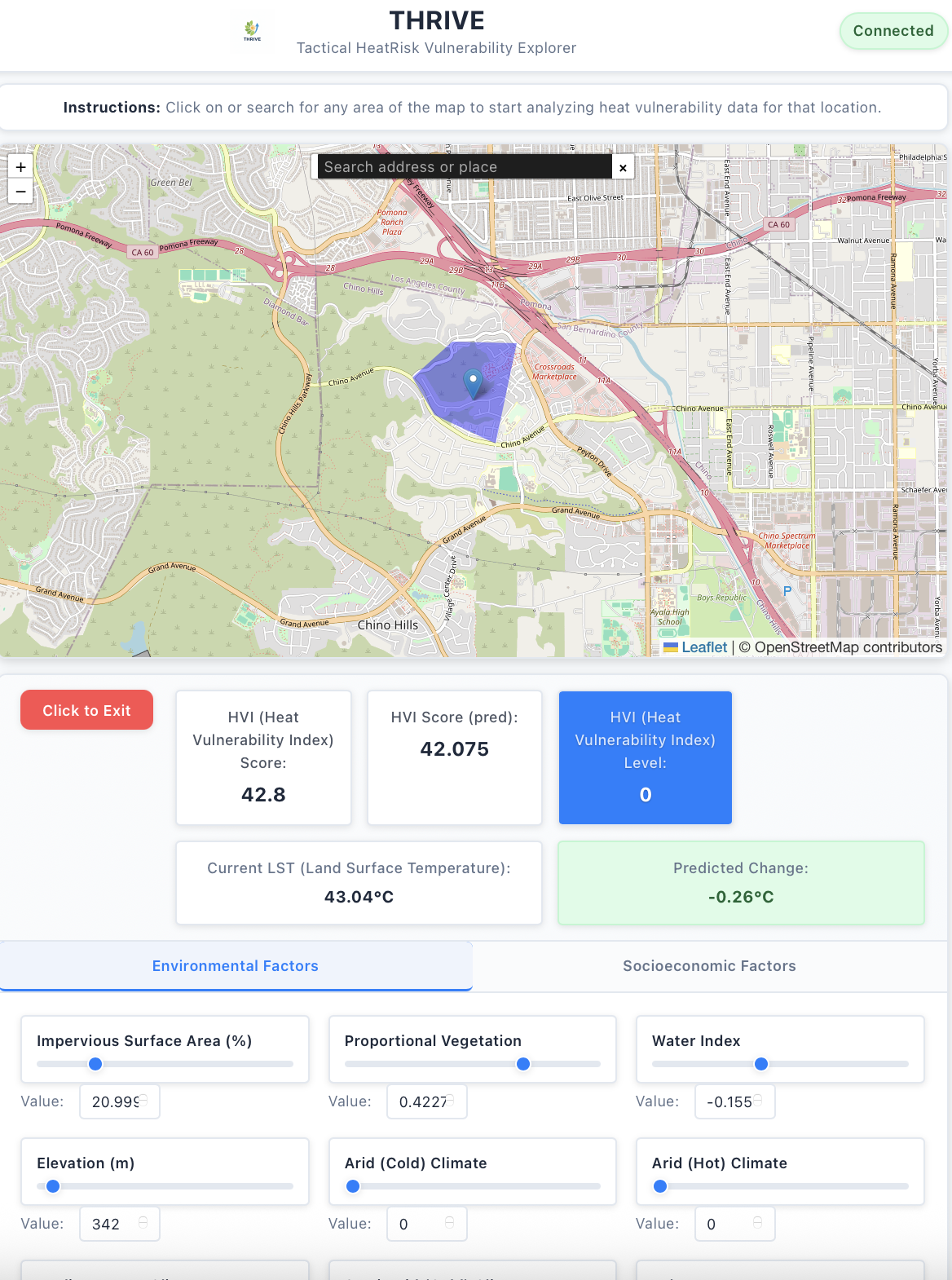
Tactical Heat Risk Vulnerability Explorer - THRIVE App
Revolutionary app providing real-time heat risk assessment for communities and individuals.
Protecting Communities Through Technology
The THRIVE App combines environmental and socio-economic data from LSAT, census bureau and advanced ML model to predict Heat Vulnerability Index (HVI) to help communities plan safety measures during extreme heat events. Using AI model, community planners and community evangelist can model vulnerable communities and deploy mitigation strategies.
Key Features